
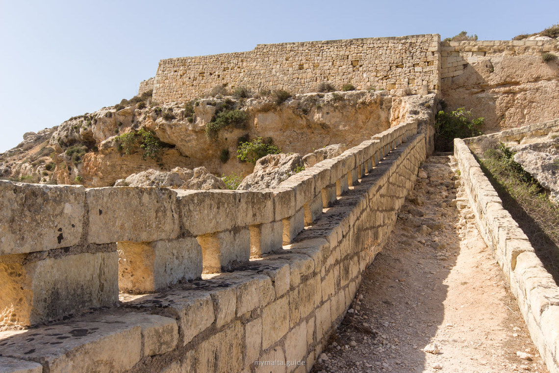
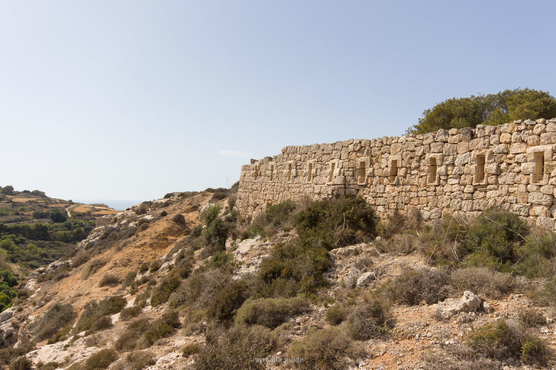
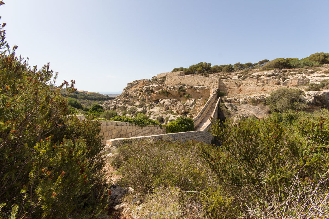
The ground tells you what this is. Across northern Malta a low, straight run of walls and earthworks follows a rise in the land, with squat stone forts set at intervals along it. It reads at first as a field boundary, and then you notice the gun positions.
A line drawn across the north
The Victoria Lines are a complex network of linear fortifications and one of the island’s most distinctive pieces of military architecture. The British built them and finished in 1897, the year of Queen Victoria’s Diamond Jubilee, which gave the system its name.
The purpose was strategic. The line was designed as a physical barrier against enemy forces landing in the north of Malta and intent on attacking the harbour installations, so vital to the maintenance of the British fleet, the source of British power in the Mediterranean.
What it is made of
The system spans some 12 kilometres. It is not one wall but a combination of different types of fortification: forts, batteries, entrenchments, stop walls, infantry lines, searchlight emplacements and howitzer positions. Each element had a role in holding an attacker on the northern side while reinforcements arrived.
The line follows a natural ridge, a long geological break across the island that made a convenient natural obstacle. Forts such as Bingemma and Mosta Fort are among the surviving elements, and the stop walls tie the whole composition together across the dips and rises.
Never tested
The defences were never tested in battle. No invasion came through the north, and the Victoria Lines were never fought over. That is why so much of the structure survives, and also why it feels more like an installation waiting for an army than a battlefield.
Walking along it, it is worth remembering how the Maltese landscape looked when the line was built: open fields, few buildings, long views to the coast. Today towns have grown towards the line, and in places it sits at the edge of housing, which changes its character.
Walking a section
Choose a stretch and treat it as a countryside walk with history. The terrain is open and mostly dry, with stone walls, scrub and small fields. Paths are uneven in places, and some structures are not maintained, so stay on the tracks and do not climb on old walls.
A section can be walked in an hour or two, and a longer outing can link several forts. Spring is the best season: the fields are green and the temperatures are comfortable. In summer the line has very little shade, so go early.
Take a map or a phone with offline maps. Waymarking varies and some stretches are not obvious on the ground. Carry water, wear closed shoes with grip, and use sun protection.
Pairing it with nearby places
The line sits close to several other places worth a visit. The Mosta Dome, one of the largest unsupported domes in Europe, is nearby, and the Ta’ Bistra Catacombs are among the places listed close to the line. The Wied il-Ghasel valley, known as the valley of honey, offers a green contrast to the stone.
A good day combines a morning walk on the line, lunch in Mosta and an afternoon visit to the Dome. If you have a car, add Rabat and Mdina to the west.
Reading the landscape
The Victoria Lines are easier to understand if you look at the ground first and the stones second. The line follows a ridge, so the defenders would always have had the higher ground, and the long stop walls make sense as a way to channel an attacker into the fire of the forts. Once you see that, each section becomes a small puzzle in which every wall and battery has a job.
Searchlight emplacements are a good detail to look for. They remind you that the system was used and adapted well into the twentieth century, and they give a human scale to what otherwise looks like a line on a map.
Practical points
There is no entrance and no timetable: the line is open countryside. That means no facilities along it, so bring food and water. Mobile coverage is usually good, but paths can be hard to read.
Check local information before you set out, because access to individual forts changes. Walk in the early morning or late afternoon, and finish with a coffee in Mosta, where cafes surround the square beneath the Dome.


